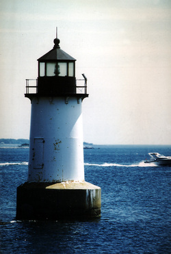
Um detaillierte Informationen zu einem Leuchtfeuer anzuzeigen, auf den internationalen Code klicken.
Alle Bilder auf einer Seite anzeigen
| Vorschau | Internationaler Code | Standort | Name | Bildnachweis |
|---|---|---|---|---|
 | J0250 | Gulf of Maine Merrimack River | Plum Island N End | OLL |
 | J0252 | Gulf of Maine Merrimack River | Newburyport Harbor South Jetty No 5 | AKB |
 | J0254.5 | Gulf of Maine Merrimack River | Newburyport Harbor North Jetty No 4 | OLL |
 | J0255.2 | Gulf of Maine Merrimack River | Plum Island Point Light P | OLL |
 | J0256 | Gulf of Maine Merrimack River | Newburyport Harbor North Pier No 18 | OLL |
 | J0266 | Gulf of Maine | Ipswich Harbor Castle Neck | OLL |
 | J0268 | Gulf of Maine Annisquam River | Harbor Wigwam Point | OLL |
 | J0271.2 | Gulf of Maine Annisquam River | Channel No 48 | OLL |
 | J0272 | Gulf of Maine Cape Ann | Rockport Breakwater Head No 6 | OLL |
 | J0274 | Gulf of Maine Cape Ann | Straitsmouth Island | AKB |
 | J0276 | Gulf of Maine Cape Ann Thacher Island | Thacher Island E side | MBN |
 | J0277 | Gulf of Maine Cape Ann Thacher Island | Thacher Island N side | MBN |
 | J0280 | Gulf of Maine Cape Ann | Gloucester Harbor Eastern Point | OLL |
 | J0282 | Gulf of Maine Cape Ann | Gloucester Harbor Gloucester Breakwater Head | OLL |
 | J0284 | Gulf of Maine Cape Ann | Gloucester Harbor Ten Pound Island | OLL |
 | J0288 | Gulf of Maine Salem Sound Bakers Island | Bakers Island N Side | MBN |
 | J0290 | Gulf of Maine Salem Sound | Beverly Cove Hospital Point Ldg Lts Front | OLL |
 | J0290.1 | Gulf of Maine Salem Sound | Beverly Cove Hospital Point Ldg Lts Rear | OLL |
 | J0294 | Gulf of Maine Salem Sound Salem | Fort Pickering SE Point of Winter Island | KPH |
 | J0295 | Gulf of Maine Salem Sound Salem | Salem No 23 | OLL |
 KML-Datei (alle Einträge) für Google Earth herunterladen
 KML-Datei (nur mit Bildern) für Google Earth herunterladen
 KML-Datei (nur ohne Bilder) für Google Earth herunterladen
 In Google Maps anzeigen (alle Einträge)
 In Google Maps anzeigen (nur mit Bildern)
 In Google Maps anzeigen (nur ohne Bilder)
 In Bing Maps anzeigen (alle Einträge)
 In Bing Maps anzeigen (nur mit Bildern)
 In Bing Maps anzeigen (nur ohne Bilder)


